Automated Obstacle Limitation Surface using & e-TOD ICAO criteria Annex 14 and Annex 15.
Software Description
Geo-Design Annexes is developed according to ICAO criteria which is stature around the world in aviation industry. This software was created to support the safeguarding personnel and IFP designers as well during their missions to calculate, design and draw all the relevant surfaces of obstacles limitations assessment that secure the deferent flight phases.
The software is developed with the capabilities that control accurate data and coordinates systems that ICAO recommends to be used in aviation as WGS-84 datum and the UTM coordinate system as well. Although basic data entrance in this software is done by users but the software is secured enough to assure that data should be interred properly according to criteria while user will get a message in case, he/she use improper data which is not compatible within the obstacle assessment stages.
AutoCAD platform was chosen to be the base line for this Geo-Design annexes software, while it works under the AutoCAD for drawing, data base setup, obstacle excel sheets, and coordinate systems that is compatible with its worldwide platform.
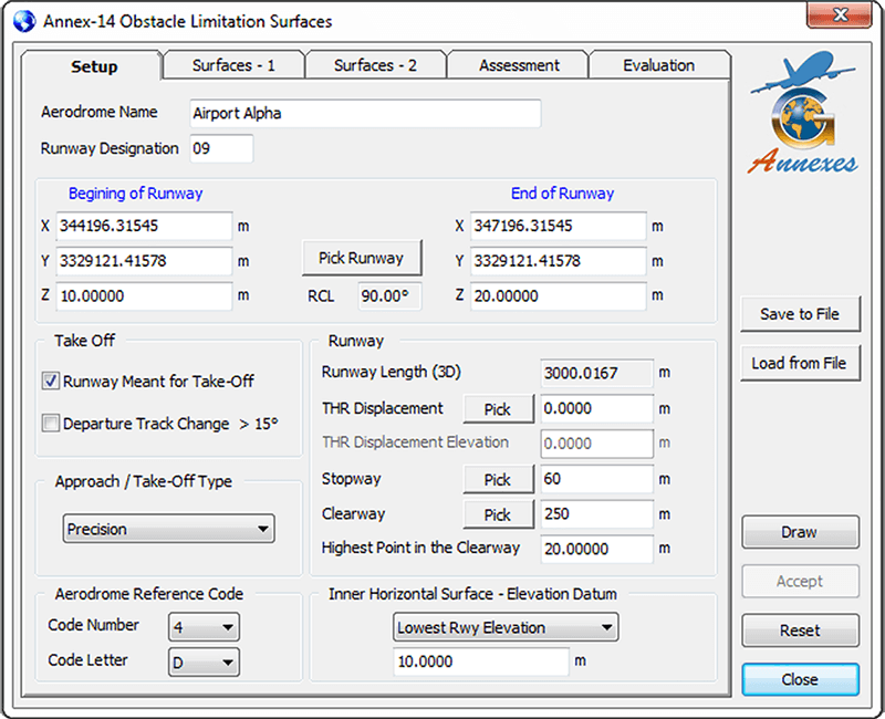
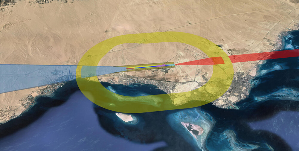
The software is divided into modules one of them creates the standard Obstacle Limitation Surfaces (OLS) according to Annexes 14, all the surfaces are created in 3D to allow full assessment of obstacles calculating the penetration amount according to its position.
Assessment report is created to show how many meters of obstacle penetration and which surface title is penetrated. Also, this software is calculating the establishment of any object (building, mast, etc.) height according to standard criteria and customer may use the software results as reference to his land assessment study.
AutoCAD platform was chosen to be the base line for this Geo-Design Pans-Ops software, as the AutoCAD is standard and known everywhere for its great capabilities in drawing, accuracy, data base, excel sheets, and coordinate systems that are compatible with its worldwide platform.
Software Operation Requirements
1 – PC / Laptop.
2 – Windows 7, Windows 8 and Windows 10 (32 bit / 64 bit).